Table of Contents
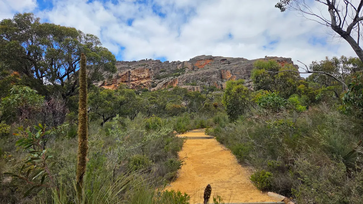
The Grampians are known as one of the best hiking destinations in Victoria, and offer many incredible trails ranging from short casual strolls to a 164-kilometre thru-hike. Most of the famous walks start within a short drive (or walk) from Halls Gap, so you can base yourself in one place and tick off the highlights over a few days.
Having been to the Grampians at least 20 times in my life, I’m sharing a list of my favorite hiking trails (with pictures), including ones that are a little off the beaten track.
Keep in mind that this guide just covers the hiking trails themselves. If you’re looking for a more comprehensive guide for the Grampians, including what to do in Halls Gap, where to stay, and what a trip here usually costs, read my full Grampians guide here: Grampians travel guide.
Quick note: If there’s any confusion or you’re after more information while you’re at the Grampians, go to the visitor center in Halls Gap. They have giant interactive maps and a whole lot of information on the different hiking trails. The staff are also very knowledgeable.
How to Plan Your Grampians Hikes
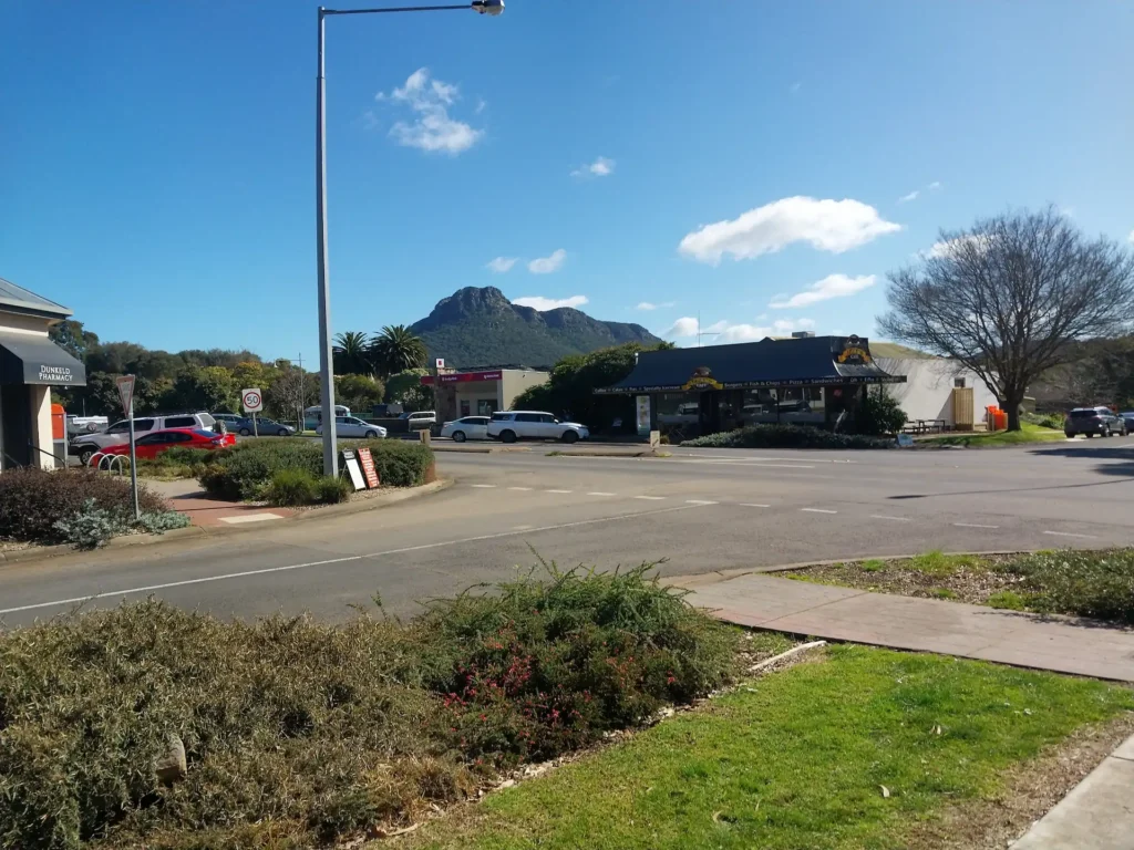
The Grampians is quite an extensive park, and it’s spread across three general areas: The central Grampians around Halls Gap (where most people base themselves), the Southern Grampians near Dunkeld, and the Northern Grampians, which are a bit rockier and quieter.
Halls Gap is the main spot people go to. This area is undoubtedly beautiful as it’s located in a valley, has the only real town in the Grampians (including the supermarkets, almost all the restaurants, and accommodation), and the famous walks are all in immediate proximity. Therefore, if you’ve only got a few days or you’re coming in by bus, it’s best to base yourself in Halls Gap and do the hikes within reach.
Also worth mentioning…
The Grampians have seen some hefty bushfires over the years, which have burned through most of the park. The impact this has on you now is minimal because, for the most part, everything is open again. But it’s worth noting that some tracks can remain closed for years if they’ve been affected by bushfires, and much of the Grampians is still visibly charred.
With that said, let’s look at my favorite Grampians hiking trails!
The Pinnacle
Let’s start with the crown jewel of the Grampians: The Pinnacle.
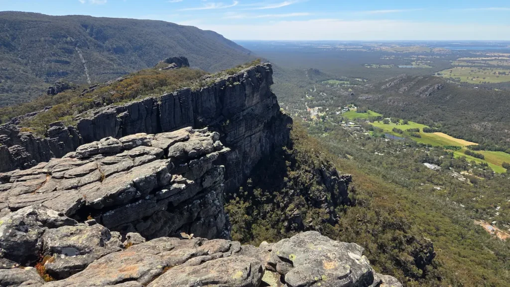
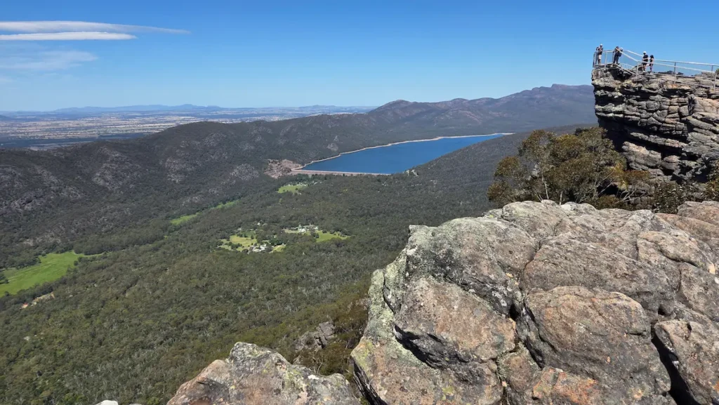
The Pinnacle is by far the most popular walk in the park. It’s a rocky climb that finishes at a clifftop lookout with sweeping views over Halls Gap and Lake Bellfield. The summit sits roughly 500 metres above the town below. There are three ways up, and the route you pick changes the whole experience.
I usually walk from Halls Gap via Venus Baths. This is a 10-kilometre return walk that takes roughly 2-3 hours up and an hour back down. The trails are marked and easy to follow, and I would say it’s a reletively difficulty hike due to steep stretches, steps, and rock scrambling in places.
Just before you begin the trail from Halls Gap, there is a fork in the road. The path on the left leads up some steps, and the path on the right leads to Venus Baths. I definitely don’t recommend taking the steps unless you want to put yourself in a world of regret. The steps are a vertical ascent all the way to the peak. The path that runs through Venus Baths is longer, but flatter and much more scenic. The hike essentially does one big loop, so you can come down via the steps, and you’re not missing anything.
You can also drive to Wonderland Carpark, which brings you straight to the best parts of the hike and cuts the distance in about half. Otherwise, you can also drive up to the Sundial Carpark, which suits families with young kids or anyone who just wants to reach the lookout without much fuss. The catch is you miss the Grand Canyon and Silent Street, which are the best parts.
Most of the trek is along bedrock plotted with trees, scenic views, streams, and a couple of waterfalls. Many parts of the hike spread out onto open areas filled with rock towers, coves, small caves, and bushland. This means it’s a great place for exploring, as you can either stick to the marked path or get off the beaten track and explore the vast rocky landscape on your own terms.
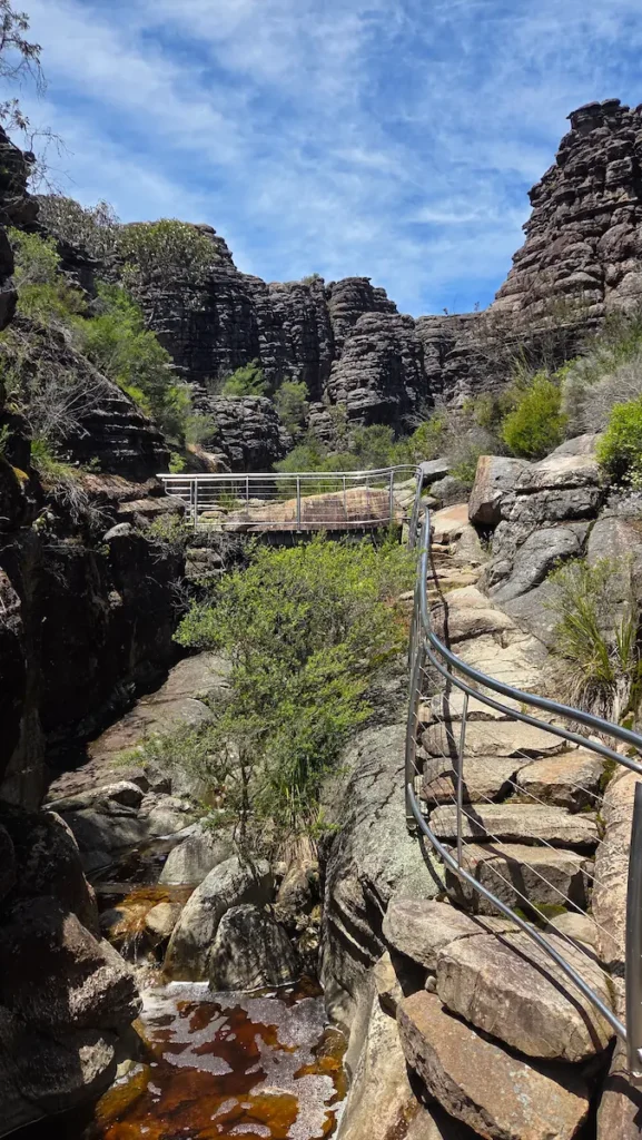
The Pinnacle hike has two highlight moments, which are the Grand Canyon and Silent Street. These are beautiful and unique spots that you probably won’t see anything like anywhere else in the world. The Grand Canyon is a crevasse made from towering pillars of sandstone. The trail winds through it, running parallel to a stream, and you climb to the top at the end, where the path spreads out to rocky plains.
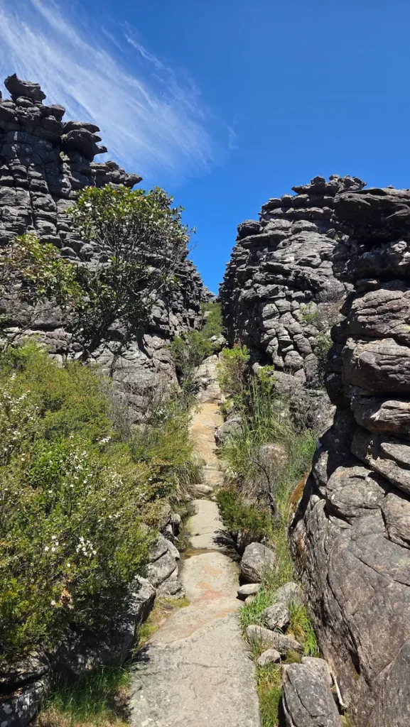
Silent Street is also a highlight. It’s a long, narrow cleft between two vertical walls of sandstone, in places barely shoulder-width, with stone steps built into the floor. You climb up through it with rock towering on both sides. Genuinely a unique stretch.
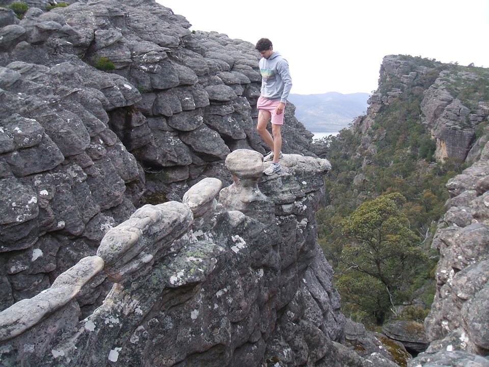
Whichever route you take, wear shoes with grip. There are stone steps, uneven rock, and quite a bit of rock scrambling. Aim for morning light and cooler air. Take a layer since it’s often windy at the lookout. There’s also one more feature worth mentioning, which is The Nerve Test. The Nerve Test is a narrow column of sandstone jutting out, with big drops on each side.
If you’re brave enough, you can walk across this narrow bridge. I did when I was younger, but definitely wouldn’t do it again as there’s nothing to hold onto, and if you fall… Let’s just say, you don’t want to. But completely understandable if you don’t want to do it yourself, you can sit around having a picnic, and gaze at the obscure site.
Venus Baths and easy walks near town
If you honestly can’t be bothered doing the full Pinnacle Hike, the Venus Baths Loop is a flat, easy walk starting right from Halls Gap. It’s a 2km loop that follows a river with rock pools and forest, and you’ll often see wildlife along the way. It’s a good first walk to shake off any nerves, and if you want to extend it, you can always take the trail leading to the Pinnacle, which branches off from this loop. The Venus Baths loop starts from the Botanic Gardens car park and follows Stony Creek. Give yourself about an hour to do it.
MacKenzie Falls
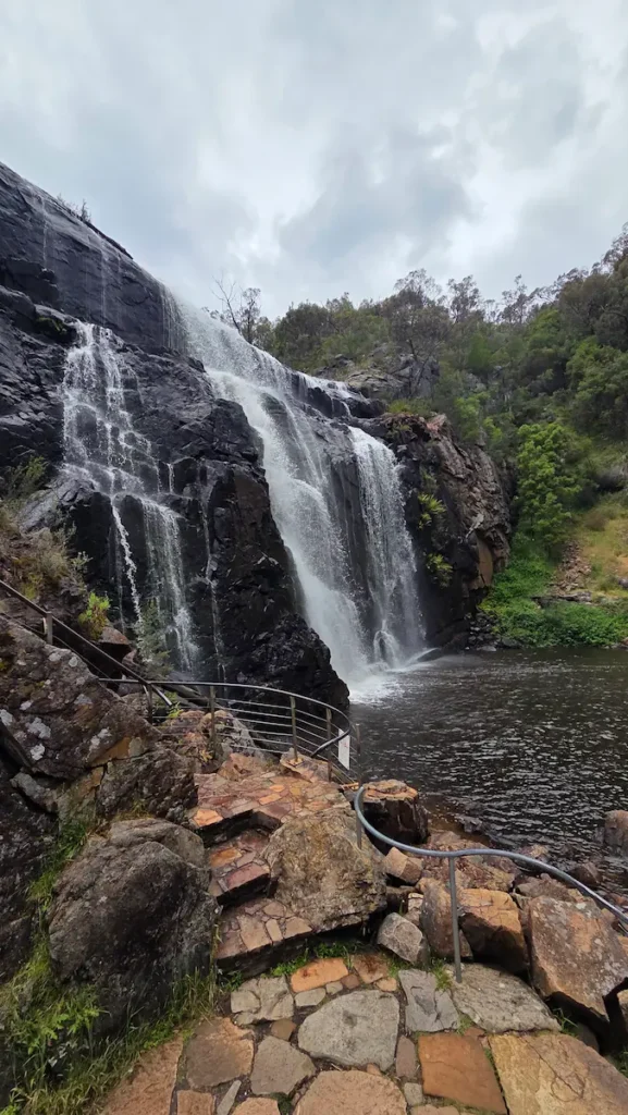
The main waterfall at Mackenzie Falls, Grampians
MacKenzie Falls (Mikunung Wira) is the standout waterfall in the Grampians and one of the largest in Victoria. It’s also the only waterfall here that flows year-round, so it doesn’t really matter what time of year you go, there will always be water passing through. You cannot swim at the base of the waterfall, so don’t get your hopes up to go for a dip. The currents and submerged rocks are dangerous, and the signs are there for good reason.
The walk from the car park down to the base is short, around two kilometres return, but steep on the way back up. There’s also a sealed path to the Broken Falls lookout nearby if you want the view without the full descent. For a quieter approach, start from Zumsteins and follow the river trail.
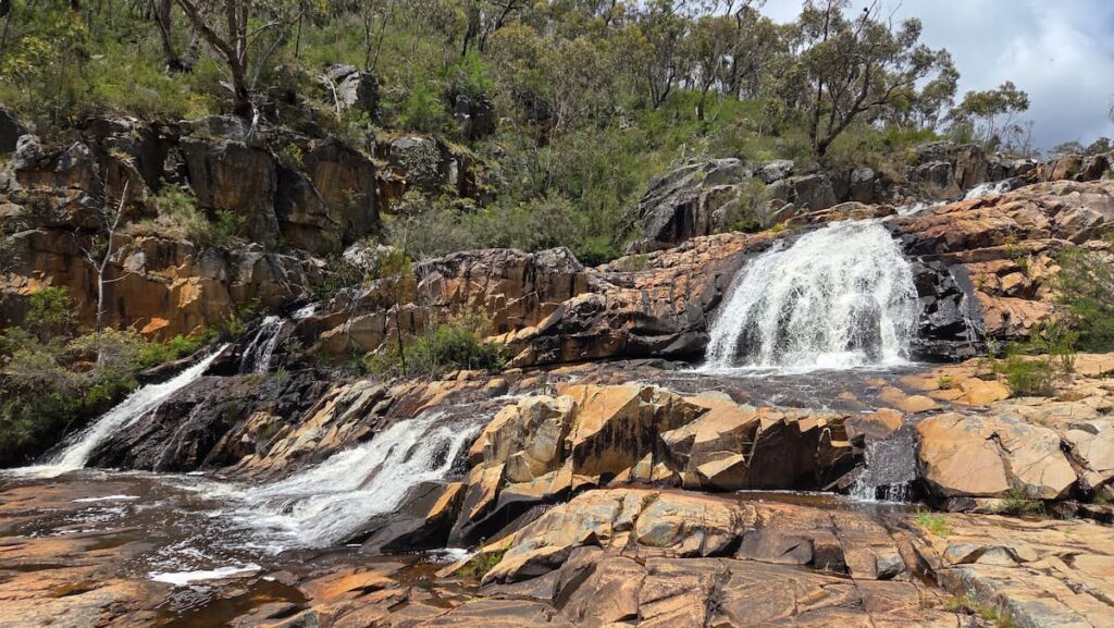
Most people just go to the base of the waterfall and call it a day. But you’re missing most of the adventure if you do that. There’s a path running parallel to the river through the valley, and you can walk for quite a ways, about 3km each direction.
This is a fairly casual, scenic walk, so the difficulty doesn’t quite compare to The Pinnacle. The end of the trail will open up to a picnic area, which has huts, picnic tables, and public BBQs. There is also a car park there for anyone who wants to start with the hike and finish up at the waterfall. I think it’s quite a nice hike and definitely worth doing for the serenity and quiet you get while walking along the river. You also rarely bump into other people, so it feels more remote.
Alternatives?
While Mackenzie Falls is the main waterfall in the Grampians, there are also other waterfalls not too far away that make a good alternative if you’re looking for spots that are a little quieter, including:
- Silverband Falls: This is a short, easy walk of around one kilometre return through fern-filled forest. It’s not going to blow your mind, and the area has visible scorch marks from a previous fire, but it’s a good leg-stretcher between longer walks, and far less busy than MacKenzie. It’s also quite close to Halls Gap, so it’s easy to do in an hour.
- Beehive Falls is another waterfall that sits in the northern Grampians and is one of the better waterfall walks on that end of the park. The walk is around three kilometres return. If you’ve got the energy, you can keep going from the falls up to Briggs Bluff for a much bigger day and some excellent views, but that turns it into a serious hike rather than a stroll.
Hollow Mountain (Wudjub-Guyan)
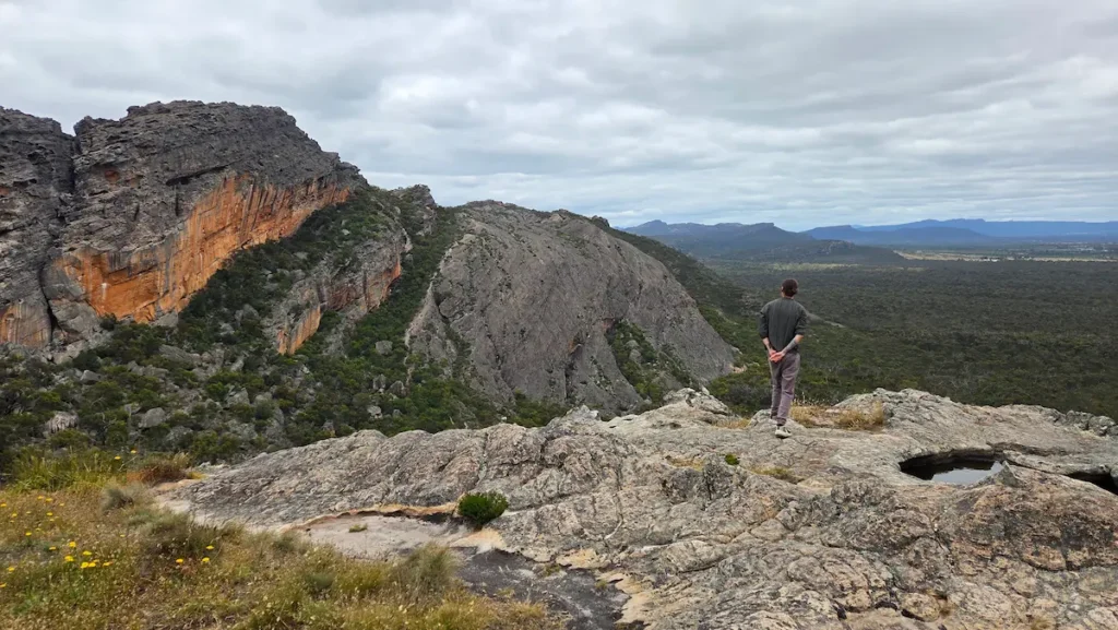
Hollow Mountain is one of my favorite hikes in the Grampians, but it’s a little far from Halls Gap. This spot is right at the Northern tip of the Grampians, so expect about an hour’s drive from Halls Gap, mostly due to the dirt road the whole way, which reduces your speed to about 30 km/h. But if you can stomach the drive, it’s definitely worth the distance.
Overall, Hollow Mountain is one of the more adventurous hikes. It’s only about 2.2 kilometres return, but don’t let the distance fool you. The track is generally quite steep, involving a lot of rock-hopping and scrambling. Some parts can feel a little sketchy as you climb up rock faces next to a vertical drop, but generally it’s safe enough, well marked, and fun.
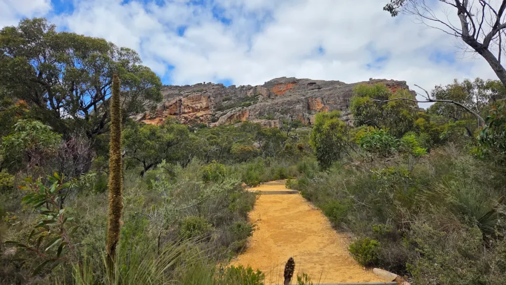
Once you climb up, it feels a little bit similar to The Pinnacle. You have expansive rocky slopes to explore with no real path anymore, so you can follow the markers to a nice little lookout point, or spend some time exploring the mountain top. There are also several wind-carved cave chambers high in the rocks that you can climb up and explore for a real adventure. Feels like parts of the mountain are hollow, giving the place its name.
The area overlooks the Northern Grampians and surrounding plains with stunning views over the Mount Stapylton Amphitheatre and the Wimmera plains beyond. Wear sturdy shoes with proper grip, and skip it in the rain, as climbing those slopes can be dangerous when wet.
Related Tracks
While you’re up in the North, there are a few other hikes in the immediate proximity that are also worth checking out, including:
- Mount Zero (Mura Mura): The northernmost peak of the Grampians and the starting point of the Peaks Trail. It’s a short walk, around 2.2 kilometres return, but a steep, rocky one, with views out over the Wimmera plains.
- Mount Stapylton Loop: Runs through the heart of the Grampians climbing scene, including the famous Taipan Wall, so you’ll likely see climbers at work.
- Gulgurn Manja Shelter: An easy walk that leads to a sandstone overhang with Aboriginal hand stencils, well worth the short detour.
Mount Abrupt (Mud-Dadjug)
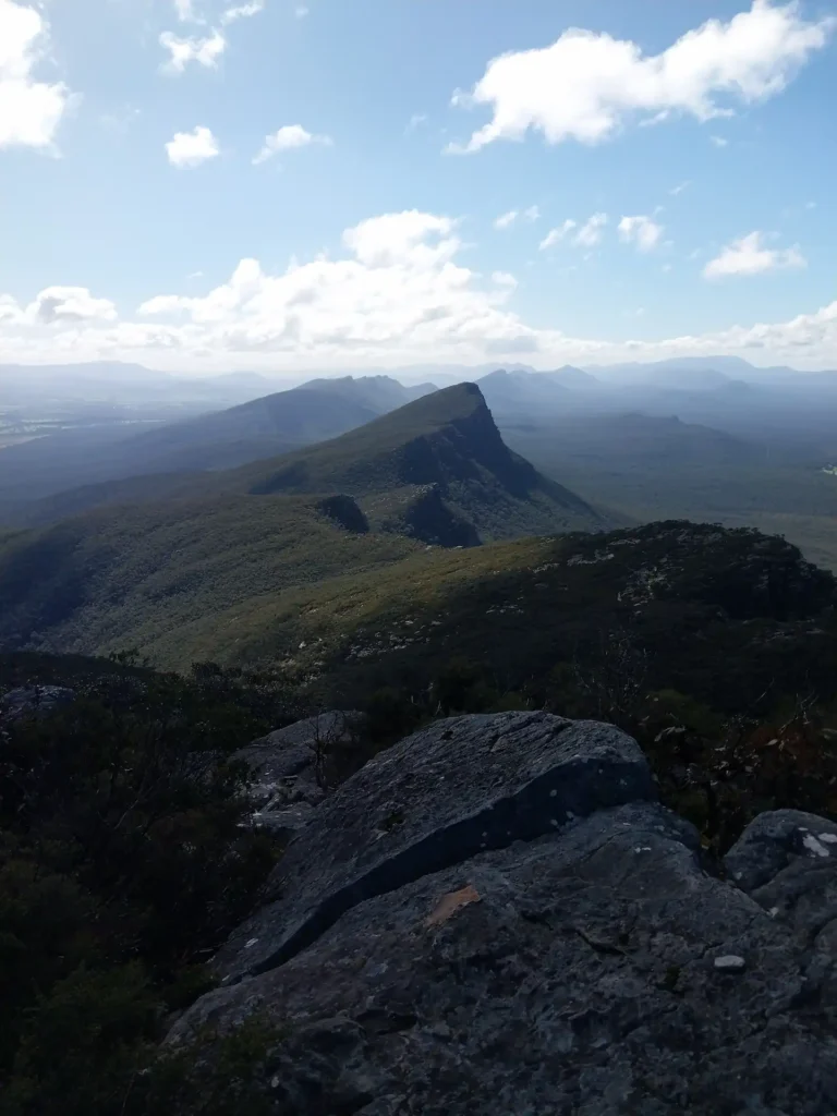
View from the summit of Mount Abrupt over the Southern Grampians
Mount Abrupt, known as Mud-Dadjug, is the standout summit walk in the southern Grampians, near Dunkeld. It’s around 6.5 kilometres return and takes about three hours. It’s a genuine climb, graded hard. I’ve only climbed this peak a few times in my life as it’s quite far from Halls Gap, but if you want a solid, full-day hike, this will do the trick.
The track rises steadily through woodland and rocky slopes, with some loose rock and short sections of scrambling near the top. From the summit, you get sweeping views across the Serra Range and out over Dunkeld and the volcanic plains to the south.
Cliimbing Mount Abrupt is usually best in spring and early summer, when the southern Grampians’ wildflowers are out. The car park is on the east side of Grampians Road, about four kilometres from the Victoria Valley Road intersection.
The Balconies and Reed Lookout
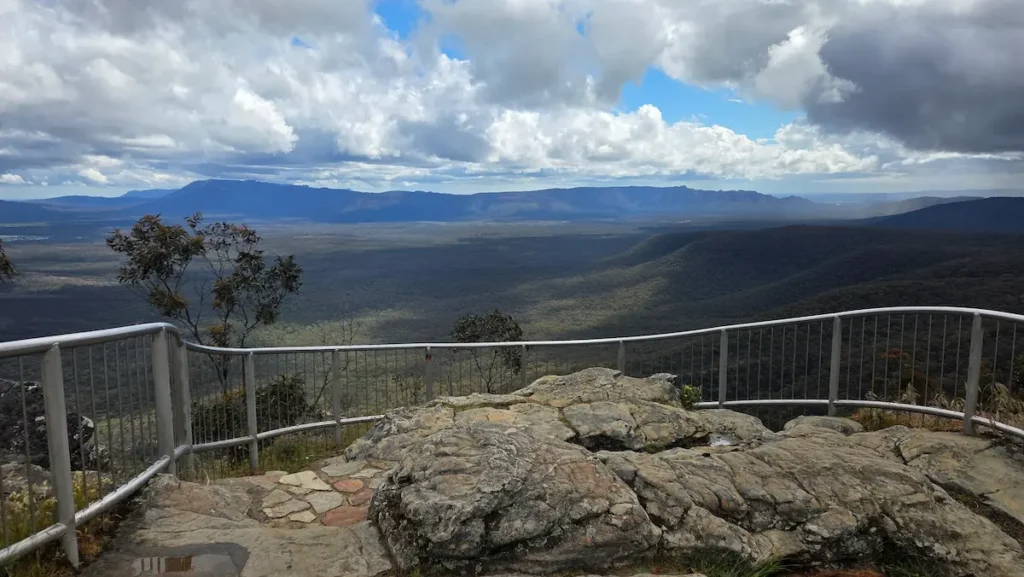
Reed Lookout and the Balconies are both reached from the same car park, and together they make one of the easiest high-reward stops in the park. It takes about 20 minutes to drive here from Halls Gap.
Reed Lookout is basically at the car park, with a short, flat path to a wide view over Victoria Valley. From there, the walk out to the Balconies is around two kilometres return on a well-formed, mostly flat track, taking about 45 minutes. The Balconies are the iconic layered rock ledge you’ve probably seen in photos. You can’t climb onto the rock jaw itself anymore, since it’s fenced for safety, but the viewpoint is still excellent and really gives you a sense of the Grampians.
This is one of the best sunset spots in the Grampians, so it gets busy in the evening and the car park can fill up. Arrive early if you’re chasing the light. While you’re in this part of the park, Boroka Lookout is another nearby drive-up viewpoint, with a short walk to a platform overlooking Halls Gap and Lake Bellfield. Between Reed, the Balconies, and Boroka, you can see the best of the Grampians’ big views in an afternoon without a hard walk.
Mount Rosea
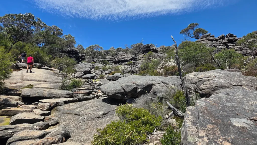
Mount Rosea is one of the more underrated walks in the central Grampians. It’s a longer, harder day, around 12 kilometres return and four to five hours, but it sees a fraction of the Pinnacle’s crowds. But it follows the same mountain strip as the Pinnacle, so you can expect a pretty similar feel to it, meaning lots of open rocky areas to explore, some rock scrambling, and great views.
The route winds through some of the most dramatic sandstone formations in the park, with narrow passages and big exposed slabs, before opening up to wide views across the ranges. If you’ve already done the Pinnacle and want something with the same character but more solitude, this is the one.
Mount William (Duwul)
Mount William, or Duwul, is the highest point in the Grampians at 1,167 metres, and it gives you 360-degree views over the entire range and the plains beyond.
The walk itself is short, around 3.5 kilometres return, but steep, on a sealed road that climbs to the summit. Allow around 1.5 to 2 hours return, or about 45 minutes up if you’re reasonably fit. You drive most of the way up the mountain, park, and walk the final stretch on foot. It’s roughly a 25- to 30-minute drive from Halls Gap.
One thing worth noticing on the way up is how the plants change with altitude. Tall eucalypts on the lower slopes give way to dwarfed, windswept scrub near the top, a small taste of sub-alpine country. In winter, you can occasionally find snow up here.
The summit has a few communications towers and a monument to Major Thomas Mitchell, who first climbed it in 1836. It’s one of the best sunrise and sunset spots in the park, so time your visit if you can.
Boronia Peak
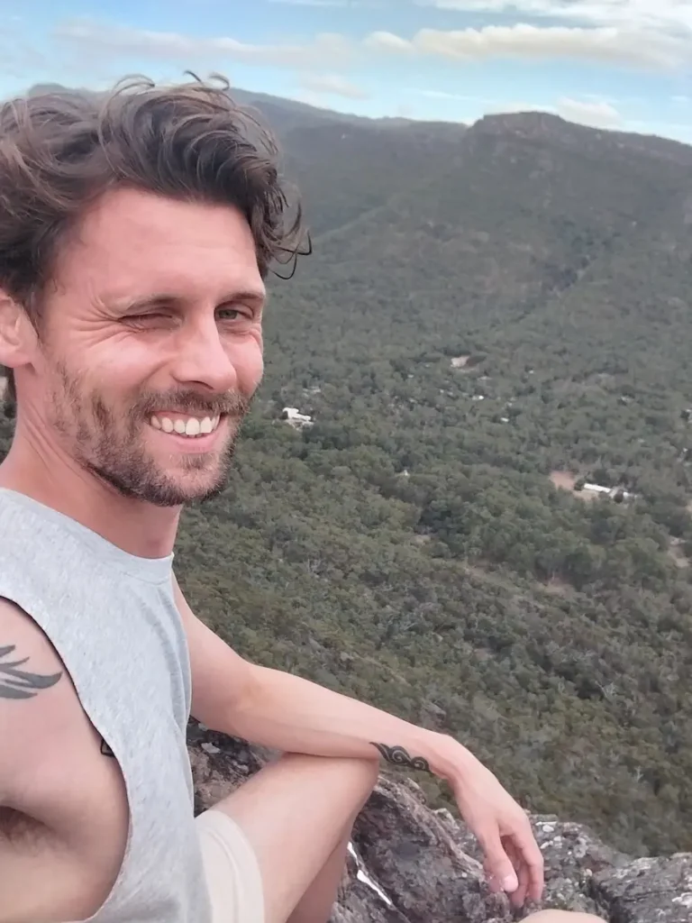
Me at the top of Boronia Peak overlooking Halls Gap
Boronia Peak is a classic for me, and one of the hikes I regularly do when I come to the Grampians. It connects to the valley walk and starts just a short distance from Halls Gap, so you don’t need to travel or anything like that.
It’s quite a long hike, around 10 kilometres return, and takes three to four hours. I would consider this hike to be more on the trickier side because it’s constantly uphill. The trail is windy and climbs steadily, with a rocky scramble near the summit. But it rewards you with views east towards Lake Fyans and across the Fyans Valley.
Because it’s less famous than the Pinnacle, you’ll often have long stretches of it to yourself. From the top, you can also link onto the Fyans Creek (Barri Yalug) Loop and walk through to Brambuk if you want to extend the day.
Valley Walk
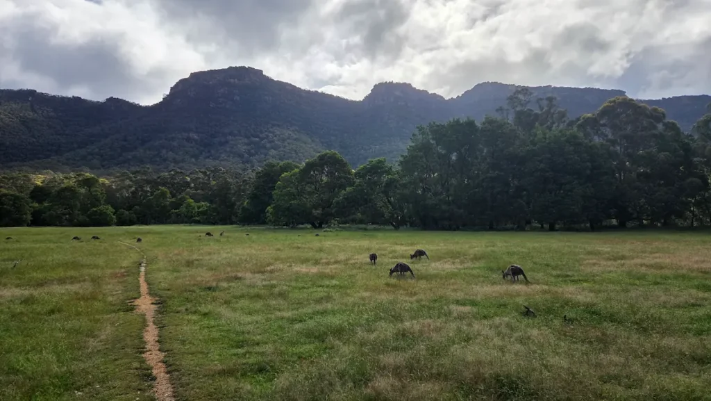
I wouldn’t consider the Valley Walk as one of the Grampians’ supreme hikes. It’s more of a casual stroll that runs along the valley floor, through Halls Gap, the Botanic Gardens, and to the Aboriginal Center, which is a cultural center in the shape of a cockatoo, surrounded by woodland.
The Valley Walk is a flat hike that partially runs along the main road with a concrete footpath, but most of it is a little off the main road, so it feels immersive in nature.
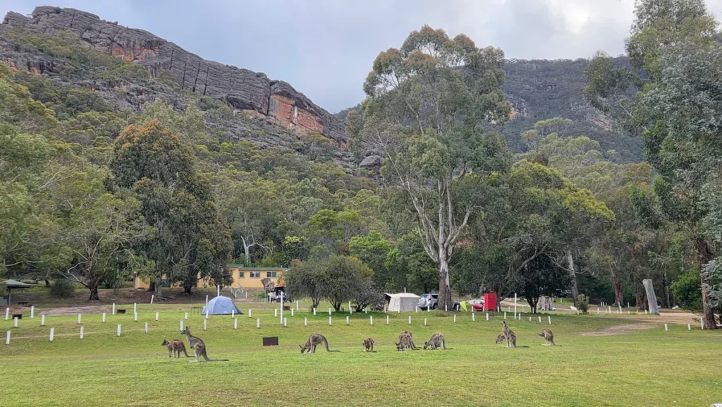
This is definitely the best walk to see wildlife, especially in the open fields, like the photo above. You’ll see giant groups of kangaroos grazing in the meadows, emus running free, and mountain goats. You’ll also see a whole variety of Australian birdlife, from Kookabarras to cockatoos, rosellas, galahs, and currawongs. And don’t you worry, you’ll definitely hear them before you see them.
Several trails connect to the Valley Walk, including Boronia Peak, the Wonderland Walk, Venus Baths, and Mount Rosea, so you can easily extend the hike if you want. It’s a good choice for a rest day, or for anyone who wants the scenery without the climb.
The Grampians Peaks Trail
For experienced hikers, the Grampians Peaks Trail is a 164-kilometre, multi-day route running the length of the range, with hike-in campgrounds along the way. I’ve personally never done this one myself, but I’ve met plenty of people who have.
The full trail runs from Mount Zero in the north to Dunkeld in the south and takes around 11 to 13 days end to end. It’s graded 4 to 5, with steep climbs, exposed ridgelines, and long remote stretches, so it’s strictly for well-prepared, experienced multi-day walkers.
You don’t need to do all of it. Many people walk a two-or three-day section and treat it as a taste of long-distance hiking.
If you want a shorter taste, popular sections include the central stretch through the Wonderland Range (which takes in the Grand Canyon, Silent Street, and the Pinnacle) and the southern climbs over Mount Abrupt and Mount Sturgeon near Dunkeld. The remote campgrounds along the trail must be booked in advance through Parks Victoria, and they book out in peak season.
Difficulty Comparison
| Walk | Distance | Difficulty | Time | Good for |
|---|---|---|---|---|
| Reed Lookout & Balconies | 2 km return | Easy | 45 min | Big views, no climb |
| Silverband Falls | 1 km return | Easy | 30 min | Quick waterfall stop |
| Venus Baths Loop | 2.3 km return | Easy | 1 hr | First walk, families |
| Mount William (Duwul) | 3.5 km return | Moderate (steep) | 1.5 to 2 hr | Highest point, 360 views |
| MacKenzie Falls (base) | 2 km return | Moderate (steep return) | 1 to 1.5 hr | Best waterfall |
| Beehive Falls | 3 km return | Moderate | 1.5 hr | Quiet northern falls |
| The Pinnacle (Wonderland) | 4.2 km return | Medium/Hard | 3 to 4 hr | The classic, Grand Canyon & Silent Street |
| Boronia Peak | 10 km return | Moderate | 3 to 4 hr | Quieter summit |
| Hollow Mountain | 2.2 km return | Hard (scrambling) | 1.5 hr | Short but adventurous, north |
| Mount Abrupt (Mud-Dadjug) | 6.5 km return | Hard | 3 hr | Southern Grampians challenge |
| Mount Rosea | 12 km return | Hard | 4 to 5 hr | Rock formations, few crowds |
| Grampians Peaks Trail | 164 km | Very hard | 11 to 13 days | Long-distance thru-hike |
With all of that said, if you are into hiking and want to see some of Victoria’s best, the Grampians is a world-class hiking destination that will give you a true taste of quintessential Australia. So whether you’re visiting Melbourne for a short time or are a Victorian resident, don’t skip over this hidden gem.